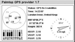
This page contains
information on GPS, the Global Positioning System. GPS is the main system
in use today to pinpoint your location anywhere on the globe.
What is GPS?
GPS receivers are able to obtain their location by acquiring a signal from some of the 27 satellites that orbit the globe.
The GPS system, originally for use by the US military, is now available to all for location-finding and navigation.
With a GPS receiver, road warriors, pilots, ramblers, and nautical folk
can find out where they are, plan routes, help get on the wrong track
when lost, and generally make travelling a whole lot easier.
A GPS receiver
makes use of signals received from the satellites, using three or more
to pinpoint your position. Obviously, you need line-of-sight for this
to work, so your receiver must be able to see the sky.
GPS Solutions
In-car units  |
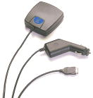
If you’re looking for a neat in-car solution, you could take the expensive route and get a fully-integrated solution OR go the option that makes financial sense – a small in-car box that has built-in GPS receiver, a touch screen, and the road maps of your choice. As well as being cheaper to fit, they can be removed from the car, for use in other cars or for security reasons. We’re great fans of the TomTom range, which includes the GO and the ONE products. More on our dedicated TomTom page. We also covered portable Sat Nav in Show 4 of the Frequencycast podcast |
GPS Mobile Phone
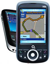 |
A very small number of mobile phones come with a built-in GPS receiver. This means that you can use the phone either in-car or on foot to work out your position and perform route-planning and door-to-door navigation. Our personal favourite GPS-enabled mobile is the Microsoft Windows Mobile powered o2 XDA Orbit (also branded as the T-Mobile MDA Compact III). This is a high-spec mobile phone, GPS receiver and PDA in one package. It also has built-in Wi-fi and Bluetooth, and a 2 megapixel camera. Available from O2’s online store (o2 XDA Orbit) or from T-Mobile (MDA Compact IV), free on selected tariffs. See our o2 XDA Orbit for more details If you’re a fan of Nokia phones, there’s the powerful Nokia N95 or the Nokia 6220, both with GPS and a 5 meg camera.
|
|
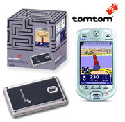
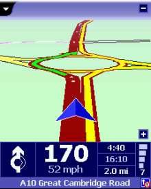
TomTom Navigator |
Prices For details of TomTom Navigator, see our TomTom Navigator page. |
|
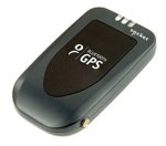
Bluetooth GPS Receiver |
If you’re
For |
|
Handheld GPS Units |
 If Ifyou’re looking for a dedicated handheld GPS navigation unit, either with onboard mapping software, or just one that reports coordinates and directions, Garmin is the most respected name in handheld GPS navigation, and they have a wide range of receivers. If you’re ever planning to use a unit with a laptop or PDA, look for one with a serial output socket. Pictured on the left is the Garmin GPS 12, an affordable 12 parallel If you’re looking for a handheld GPS unit, try Maplin, |
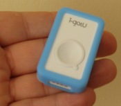 |
The tiny i-gotU GPS tracker can be used to capture your current position, or track your progress on a journey, then let you use that data on your PC or online. You can overlay your position and waypoints onto Google Maps and Google Earth, and also use it to geo-tag photos and on photo services such as Flickr and Picaso. This device is cheap, waterproof, rechargeable, and a snip at around £40. If you’re a biker or a hiker, or own a digital camera, find out more about the basic i-gotU GPS tracker on FrequencyCast’s i-gotU review. We’ve also reviewed the higher-spec version with motion detection – thei-gotU GT600 with motion detection. |
|
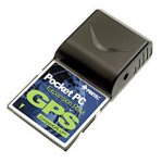
Pretec CompactGPS – Low Power CF Card |
A
snazzy plug-and-play solution for Pocket PCs. The Pretec CompactGPS comes bundled with TomTom Citymaps which makes it ideal for use with Pocket PCs. Pretec’s CompactGPS-LP is in CompactFlash form-factor which is a popular for both the new and old generation of Windows powered Pocket or Handheld PCs. It is designed for easy integration with a wide range of navigation software applications. Featuring all view tracking capability, CompactGPS provides robust performance in applications that require high vehicle dynamics and high signal blockage operations. With 8-Channel architecture technology, Pretec’s CompactGPS card can provide rapid Time-First-Fix (TIFF) under all start-up conditions for fast data acquisition and reacquisition. Available Alternatives: Bid for a bargain on Ebay.co.uk See our GPS CF card page for details |
|
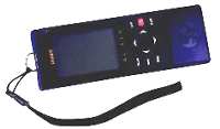
Palmtop GPS |
A product
|
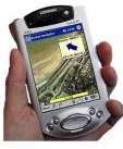 |
Ok, now this really is the ultimate! Seen 24? In this compulsive action show, one episode shows agent Jack Bauer using his palmtop to pinpoint his location on a real-time satellite map, to spot his enemies from above. Sadly, this isn’t quite what Memory Map has to offer, but it’s close… This software contains aerial photos from regions of the UK that can be downloaded to your Pocket PC. Coupled with GPS, you can get a pinpoint location of where you are, superimposed over an aerial image. Really useful stuff for hikers, bikers and pilots, who want a little more than a moving map on their palmtop. Memory Map software and maps are available from www.getmapping.co.uk |
|
PC Navigation software 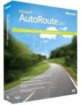 |
AutoRoute is the mother of all mapping programs for the PC. AutoRoute provides truly bucketloads of information and features. Great for mapping a route, anywhere in Europe, door-to-door by postcodes, it can be set with your driving speeds, to avoid certain roads, go the scenic route, zoom in and out, print maps and a whole stack more. Amazingly detailed, with good step-by-step instructions for your navigator. AutoRoute 2007 is available from Amazon for £39 (cheaper than on the high street). It includes the whole of Europe, and identifies restaurants, hotels, petrol stations, car parks, cash machines, train stations and pubs across Europe. |
Audio Review: Check out our Audio feature on GPS Watches, apps and trackers – FrequencyCast Show 43
GPS Frequently asked questions
| How much does GPS cost to use? |
Top question – is GPS really free? Well, yes. Apart from the one-off cost of the GPS receiver (and any software you want to buy), there’s no charge to use GPS. There’s no ‘service provider’ as such, and there’s no subscription fee for users of GPS hardware to make use of positioning data from GPS satellites. Satellite receivers detect signals from these satellites and use them to work out position anyone on the planet. These satellites were put into orbit by the US military some years back, and they subsequently opened up the system for non-military use |
| GPS Coverage | Positioning via GPS is possible just about anywhere in the world. To get your position, you need to be in line-of-sight of at least three of the orbiting satellites, which is possible all around the world. The presence of high buildings or other objects that obscure the visible line-of-sight to space will prevent reception of the GPS signal from satellites – heavy tree cover or poor weather conditions also can affect a receiver’s ability to get a decent position lock. |
| Connecting to GPS |
TomTom Navigator is supplied with GPS software as standard. This should support most Bluetooth or cable GPS receivers. For more on GPS, see our GPS page |
|
Got a question, or need help? Ask in our forum
|
GPS Links:
- See our Travel
page for information on mobile traffic and travel news. - Looking
for GPS units, leads and adapters? Try
Maplin, Dabs.com or Amazon. For a real bargain, take a look on eBay.co.uk
- GPS
Tutorial
– Help,
advice and links on GPS - Getmapping
– If you’re into maps and navigation, take a look at the overhead images,
maps, digital photos and CDs that this mapping firm has to offer - More details
of mapping software for the Pocket PC can be found here

 This
This