This page provides information on the various ways that you can obtain up-to-date UK travel news on the move.
We also look at some of the mapping solutions available, and some useful products and services to help get traffic information to you wherever you are.
Travel news online
This section contains a list of useful web links to online travel information:
| Roads |
There’s also the slightly more expensive TomTom Go 720T that has a receiver capable of getting free over-the-air travel updates using a service called RDS-TMC. TomTom SatNavs are available from Currys or Halfords. More on our TomTom Traffic News page |
| Rail |
|
| Tube |
|
| General |
|
Dial-up
travel news:
Access to real-time
road news by phone. Services use computerised voice technology to report
on road conditions. We use o2’s TrafficLine, which can identify which roads
you’re near from the mobile cellbase you’re connected on.
- O2
customers: Call Trafficline on 1200 from their o2 mobile. Calls
cost 45p per minute. Traffic data supplied by TrafficMaster. - Vodafone customers: Call 2222.
Calls charged at premium rate - Orange customers: Call 117.
Calls cost 40p per minute. Traffic data from the RAC - Home or office phones: Call 09003 401 100. Calls cost 60 pence
per minute. Traffic data from AA Roadwatch
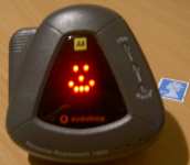 Advance
warning – Some years back, it was possible to buy a small in-car unit
to place on your car’s dashboard. These picked up signals from the Trafficmaster
sensors on motorways and some ‘A’ roads, and gave advance warning of upcoming
slowdowns in traffic flow. It would give a countdown of 15, 10 and 5 miles
before the slowdown, and an eggtimer icon to represent how serious the
slowdown was. What it didn’t give, was a reason for the holdup, which
was when it was handy to call one of the dialup automated services.
- The
‘AA Roadwatch 1800‘ was sold in Vodafone stores, online at the
Vodafone website, and by the AA. As far as we know, these little gadgets
(or anything similar) aren’t available these days. If you happen to
know of a source for the original ‘AA Roadwatch 1800’, which we got
for about £20 from Vodafone, please let us know and we’ll include
the information on this site. Looking for the instructions? Copy of instructions - A more basic
version, the ‘Cellnet Traffic Line 1200‘, was also available.
The are no longer in production either, but these frequently appear
on eBay.co.uk for around the £5-£10 mark. Well worth obtaining!
Travel news
by text message:
Getting travel and
traffic information "pushed" to you in the form of an SMS text message is
the ideal solution, but due to the cost of mass text services, this service
is fairly rare, or in some cases costly. Here are details of the travel
alert services that we know of:
- Road updates by text message – For less than 10p a day,
AA Roadwatch Mobile service includes a daily text alert, email updates
and wap access. - Daily tube status: Register free online with Transport for
London, and specify your regular journey details. You’ll receive a text
message in advance of your regular journey if one of your lines is affected.
Register at alerts.tfl.gov.uk/index. - Tube news on demand: You can send a text message to Transport
for London on the following number: 07740 11 1234 for an automated
tube status message. For details of the short codes, go to TFL
SMS services.
For
help on text messaging, and for details of free text message services,
see our SMS page.
Radio travel
news:
Another great source of travel
news comes in the form of the travel reports found on local, regional and
national radio.
The most accurate of these for local traffic conditions
tends to be local radio – In the UK, there are two main types of local radio
station, BBC local radio, and a network of independent commercial radio
stations.
Local radio source their travel news in several ways, but most commonly,
they’ll make use of the services of one of the dedicated companies that
provide voice and text reports to radio stations: Until recently, AA
Roadwatch was probably the best known of the companies providing travel
information, but changes announced in late 2004 means that their role is
to be reduced (see Times
News Story). This leaves Trafficlink as the prime source in the UK. TrafficLink rebranded to Inrix in 2012.
Some stations have their own in-house travel staff as well (normally
during peak hours only), to add a local voice to reports. Travel is gathered from various sources,
including: local police, motorway control, rail companies, courier/taxi
firms, listener "jamlines", and spotter planes.
 Most FM radio stations in the UK operate a system called RDS (Radio Data
System), where small amounts of text and data are sent out with the
radio signal. Radio receivers with RDS can display this information – most
commonly an 8-digit radio station name, or the programme type (i.e. Pop,
Rock, etc).
A very useful bit of information sent, is something called the
‘TA flag’. Standing for Traffic Announcement, this can be switched on when
a radio station starts a travel report, and switched off at the end (some
stations use three DTMF tones to trigger the TA flag). The practical upshot
of this, is that your RDS radio can switch to a station carrying travel
news, or in a car, pause a cassette or a CD, when local travel news is broadcast.
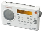
Handheld RDS radios start from about £40, and many new cars come with an
RDS radio as standard. RDS portable radios, such as the Roberts RD49 pictured
here, plus hi-fi tuners with RDS, can be found at John Lewis.
- RDS information
– More information and links on RDS - Highways Agency Radio
– Internet-based travel information - On Your PC – details of listening to radio stations from your computer
- Your station on the Internet – Tune in to your local radio
station from a PC. See a list of online UK stations at radiofeeds.co.uk. See also Radio and Telly’s Internet Radio page - Using RDS: For more on using RDS, see the BBC
RDS factsheet.
For more information on RDS and local radio in the UK, see our sister site Radio and Telly.
Recommended software
 |
In-Car satellite navigation Recommended!
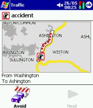
For the serious motorist, the PDA solution of choice is the excellent Use a plug-in CF card GPS receiver, For information on other navigation products, including stand-alone GPS units that can download live travel news from the Internet, see our TomTom |
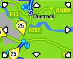 |
Road Traffic-i For more details, see our Traffic-i page. There’s also TrafficTV, available for Symbian smartphones and Pocket PCs |
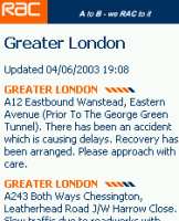 |
RAC
If you have a Pocket PC or Palm OS handheld computer, chances are |
 |
Ever wondered what your town looks like from overhead, or what a traffic |
AutoRoute for the PC
 This is the mother of all mapping programs for the PC. AutoRoute,
provides truly bucketloads of information and features. Great for mapping
a route, anywhere in Europe, door-to-door by postcodes, it can be set
with your driving speeds, to avoid certain roads, go the scenic route,
zoom in and out, print maps and a whole stack more. Amazingly detailed,
with good step-by-step instructions for your navigator.
AutoRoute
2011 is available from Amazon for £39 (cheaper than on the
high street). It includes the whole of Europe, and identifies thousands of
restaurants, hotels, petrol stations, car parks,
cash machines, train stations and pubs across Europe.
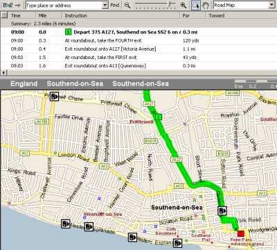
Autoroute route map, with added speed camera pushpins
Speed Camera information
You can’t have helped
but notice the increase in the number of speed cameras… not only the fixed
grey and yellow ones (known as Gatso), but the mobile units hiding around
the corner where you least expect them. Obviously, breaking the speed limit
is dangerous and illegal, but as cameras are supposed to be sited at blackspots,
knowing where they are is a great benefit.
 Looking
for a downloadable list of UK speed cameras? The best site we’ve
come across is the PocketGPS
Safety Camera Database. The database that they provide for free
download is intended to be used with TomTom’s Navigator application
on a Pocket PC (see our Pocket PC Navigator
page). If you don’t have Navigator, the list can also be converted
from the TomTom Navigator format into an ASC text file via a free application
called POIManager (from the same site). This list can then be imported
into AutoRoute
(and exported to a Pocket PC if required). The database gives longitude
and latitude co-ordinates for the cameras, which as you’ll see from
the screenshot to the right, is enough for a map program to work out
where each camera is sited.
If you’re using TomTom Navigator, you
can also use this database with the free application, CheckPOInt,
that can alert you audibly of an upcoming camera.- Speedcamerasuk
camera database – Online database of cameras, by region and by
town. Can’t be downloaded onto a map, but very handy, regularly updated,
and with useful directions and descriptions. - The other option
for being camera aware is to buy a speed camera detector – which is
the best way to keep an eye on where the cameras have got to. Better
than an online database, these small gadgets detect the radar signals
from fixed and mobile speed cameras, as well as red light cameras and
the mobile laser systems that the police are now using too. The boxes
can be a little expensive, but could save you a fine, or your driving licence.
Frequently asked questions
- So, what is
TrafficMaster? This is a network of Sensors at strategic places
along our road network. On Motorways, these are concealed on overhead
bridges, and on ‘A’ roads, these are little units on top of tall blue
poles (frequently mistaken for speed cameras!). These sensors monitor
the speed of traffic flow and report this information to the Trafficmaster
Control Room, who make the information available to motorists via in-car
units and mobile phone. For more details, go to www.
trafficmaster.co.uk
- We’re waiting
for more of your questions… Ask us a question
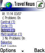
Travel news over WAP
If you have
a mobile phone that’s been on the market for the last couple of years,
chances are, it has a built-in WAP browser. This means that you can
connect to special ‘mobile internet’ pages from your mobile. On a Nokia,
you’ll find WAP under ‘Services’ in the menu.
There are several WAP services available that may be of use. Your network
operator’s WAP homepage links to travel resources, for example O2 Active "Info/Travel" page and Orange’s "Travel
and Journey" channel.
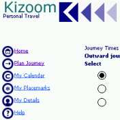
| Kizoom |
|
| TFL |
Transport |
| WAP browser |
This is available For information on how to get WAP, the mobile Internet: WAP information |
| Any web page |
The screenshot demonstrates how rail company c2c’s website looks |
| Orange |
Orange mobile customers can access road and rail travel information via the Travel channel on Orange World. They also offer the TrafficTV download that works on most modern phones, it shows delays across the UK and allows you to look at CCTV pictures. Orange users can text TRAVEL to 247 for a link straight to the travel information area of Orange World. More at www.orange.co.uk |
For help on WAP, see our WAP page.
Other useful pages:
- PDA Version – PDA and Smartphone-friendly version of this page
- On The Net #12 – Our article on mobile travel, as featured in Palmtop User magazine
- GPS
info – Help, advice and links on handheld GPS navigation - WAP
info – Getting connected to WAP from your mobile phone - PDA
info – Information about Pocket PC, Palm, Psion and Symbian
OS handheld computers - MiniGPS
/ Where I Am –
Small application for the Nokia 6600 and other Symbian
OS smartphones that lets you know where you are, based on your nearest
mobile phone cellbase. When you enter a certain cell, you can get the
application to do clever things – such as let someone know by text message
that you’ve arrived safely, or making sure that you don’t miss your
station by getting this app to wake you when you’re nearly home.
Also consider: Make life easier with a TomTom One – GPS with support for real-time travel news, to help avoid the delays

 If you’re looking for up-to-date travel news over the Internet while driving, consider a
 Billed
 Getting travel information to your mobile phone over WAP is a very
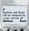 Frustratingly,